
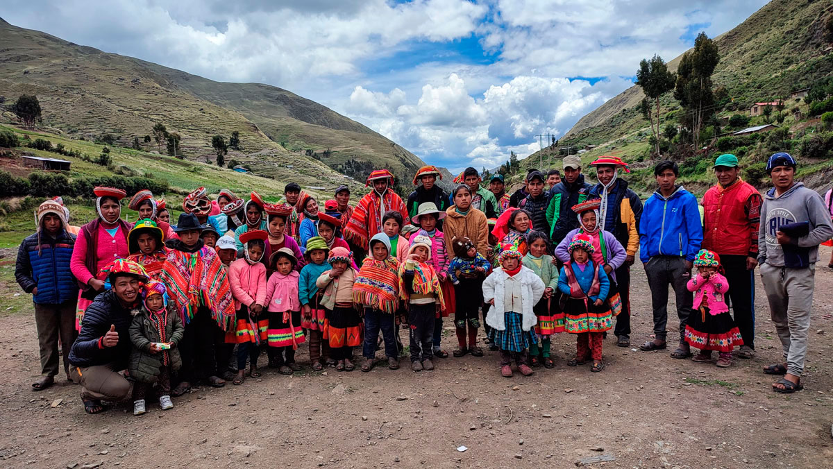
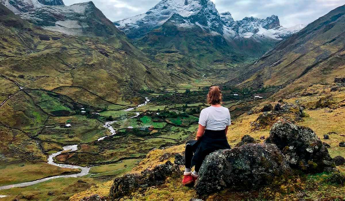
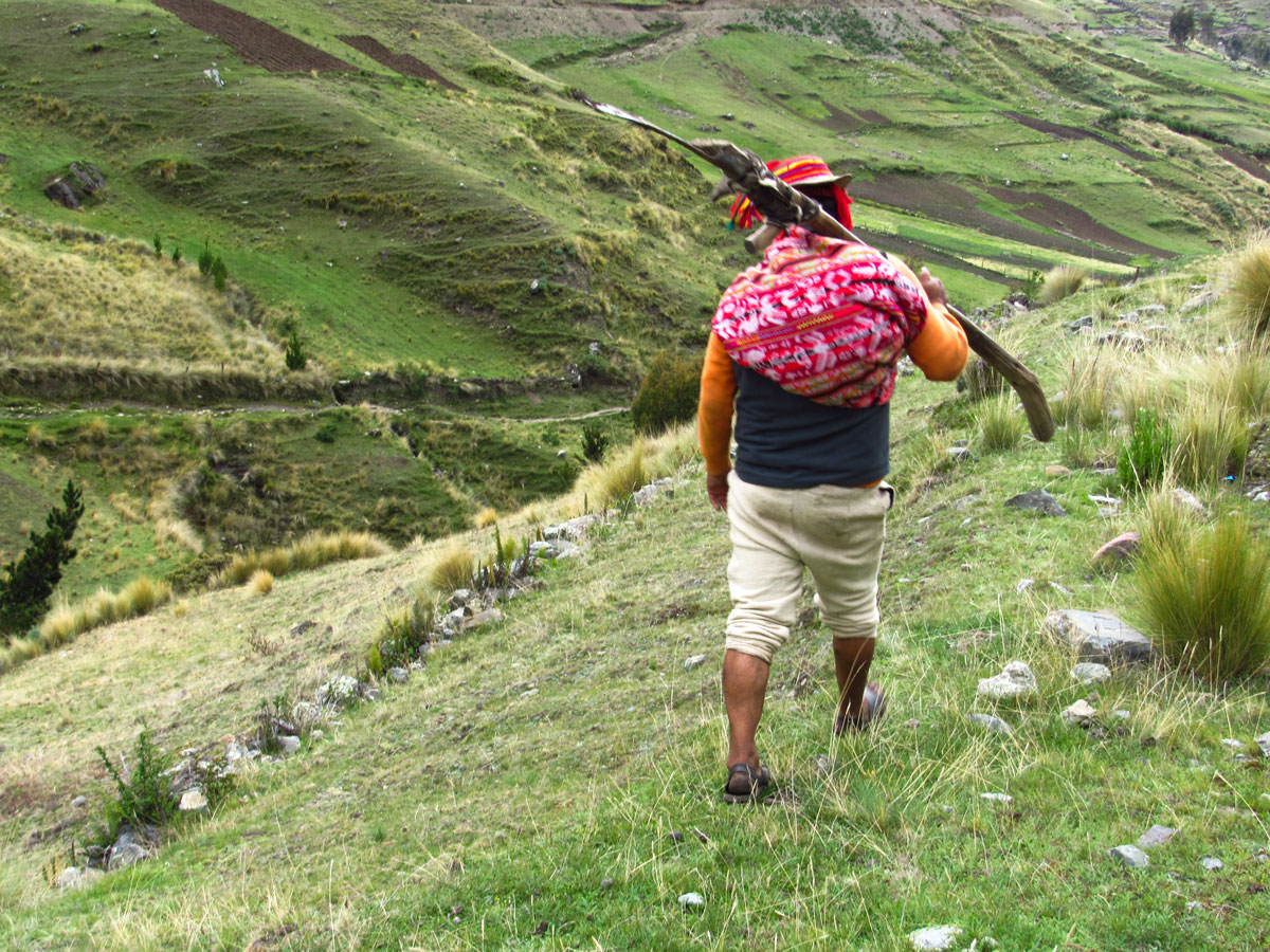
The Lares Trek has become a popular alternative to the Classic Inca Trail for visiting Machu Picchu. Unlike other routes that focus primarily on geology or archaeology, the Lares Valley provides an authentic immersion in Andean culture. As you traverse the landscape, you will pass through remote communities that preserve ancient social customs, where Quechua is still widely spoken.
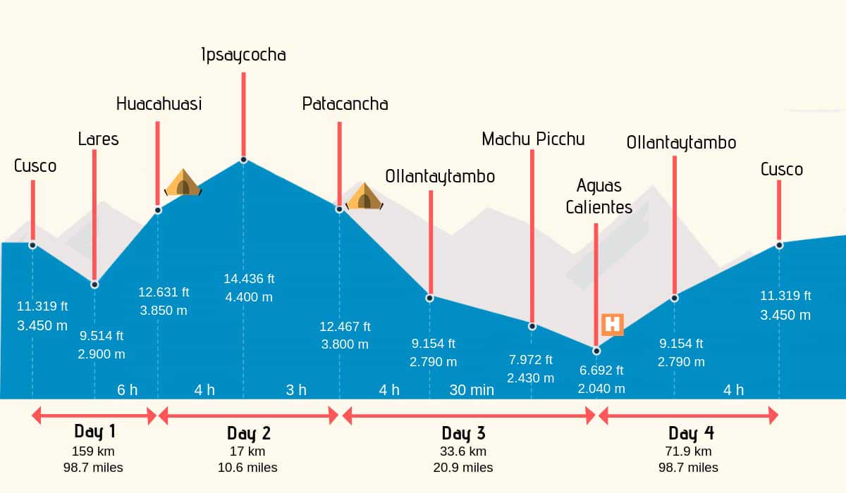
Understanding the route map is essential to mastering the logistics of this expedition. The standard itinerary covers approximately 34 kilometers (21 miles) of hiking over three days and culminates in a descent into the Sacred Valley of the Incas. From there, the route connects via railway to Aguas Calientes, leaving the entire fourth day for exploring the historical sanctuary of Machu Picchu."
Getting to know the Lares trek
The Lares Trail crosses the Urubamba mountain range and connects high Andean settlements such as Cuncani, Quisuarani, Huacahuasi, and Patacancha. This journey is known as the "Weavers' Route" in the tourism field. As travelers move forward, they can see the local people making textiles with alpaca and sheep fiber and applying spinning and dyeing techniques with natural colors.
The trail winds through native forests, glacial lakes, and high valleys. As they pass through towns, travelers will see rural architecture adapted to the cold climate, characterized by stone houses with thatched roofs. The environment also allows you to observe the herding of llama and alpaca flocks, as well as the domestic breeding of traditional Andean species like guinea pigs inside houses. Interacting with local families, with the help of a translating guide, allows you to experience firsthand the farming lifestyle that has endured in this mountainous region.
Lares Trek Map
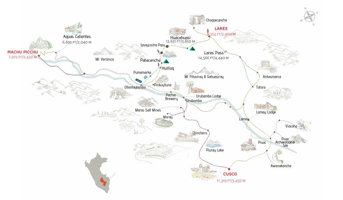
Travel Itinerary: Technical Map of the Route
The standard itinerary for the Lares Valley hike is organized into a four-day, three-night format. Unlike other expeditions, this route does not follow a single paved trail. Instead, it follows a network of rural and inter-Andean paths that connect different ecological levels and communities. To properly plan for the physical demands and acclimatization, we have provided the daily travel itinerary below:
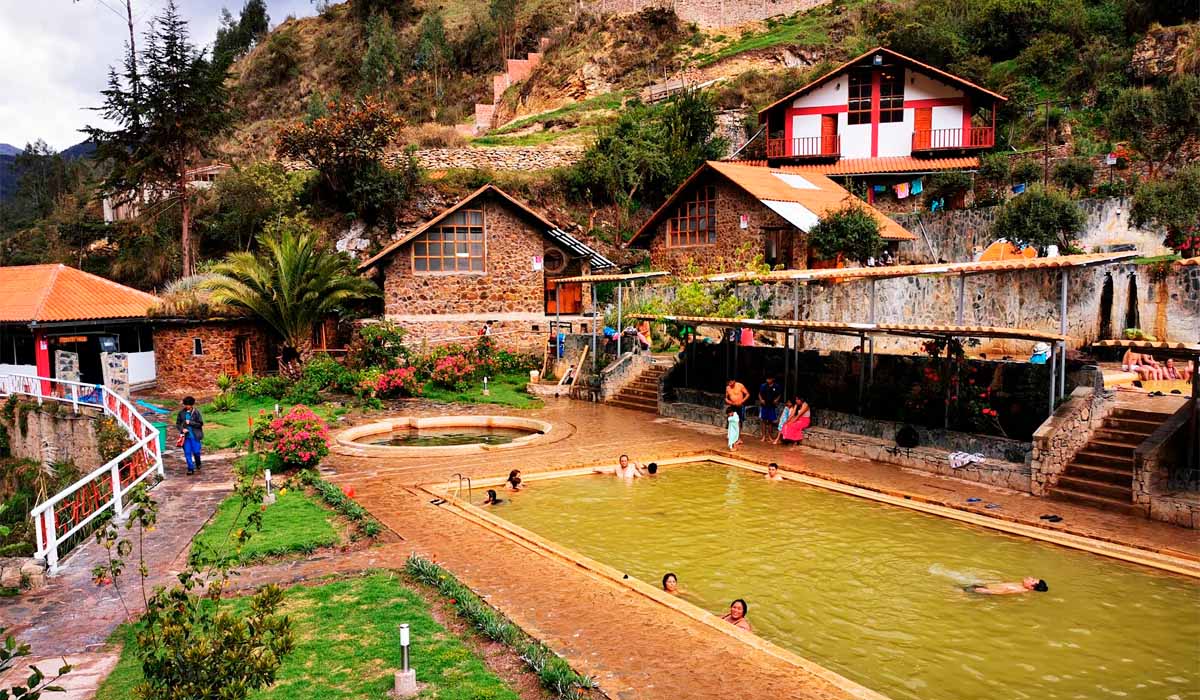
Day 1: Cusco – Calca – Lares Hot Springs – Huacahuasi
The journey begins in Cusco (11,153 feet above sea level) with pickup of travelers around 6:00 a.m. The first leg of the trip by vehicle goes down to the Sacred Valley, reaching the town of Calca (9,600 feet) after about two hours. At this point, the group will take a brief rest stop to allow travelers to rest and stock up on water or last-minute supplies.
Then, the trip continues north, climbing up the mountain range for three more hours until reaching Lares. Before starting the hike, the itinerary includes a stop at the district's hot springs, where visitors can enjoy the thermal medicinal pools.
Once this stage of acclimatization and rest is over, the first part of the trek begins. The trail requires covering 12 kilometers of steady climbing. This trek takes between five and six hours of continuous physical effort to reach the Andean community of Huacahuasi, which is located at 3,750 meters above sea level (masl). This town is known for its textile tradition and serves as the starting point for a late lunch and dinner as well as for setting up the first camp of the expedition.
Day 2: Huacahuasi – Ipsaycocha Pass – Patacancha
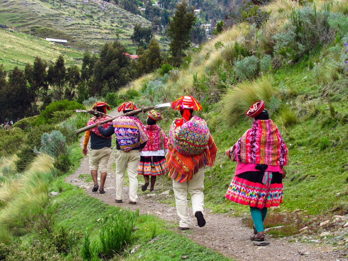
The community of Huacahuasi is known for its deep-rooted textile tradition. During the early morning hours, you can observe the local spinning and weaving processes and interact with the residents before continuing on your way. This cultural immersion is one of the main reasons this circuit is called the "Weavers' Route."
Topographically, the second day is known for having the highest physical demand and altitude of the entire expedition. The walking route begins with a two- to three-hour steady climb toward the Ipsaycocha pass, the highest point of the circuit at 4,450 meters above sea level (masl). After reaching the summit, the group descends for about an hour until reaching the shores of the glacial Ipsaycocha lake. This is usually where the group takes a break for lunch.
From the lake, the trail continues its descent for an additional two to three hours. The second day's journey ends upon arrival in the Andean community of Patacancha, located at 3,700 meters above sea level (masl). This Quechua-speaking town is where dinner is served and the second camp is set up.
Day 3: Patacancha – Huilloc – Pumamarca – Ollantaytambo – Aguas Calientes
On the third day of the expedition, there is a continuous and gradual descent heading south. The trail begins at the Patacancha campsite and leads to the Andean community of Huilloc, a settlement renowned for its traditional red and black attire. After a brief technical break, the trail continues to the Inca archaeological center of Pumamarca. This pre-Columbian complex is notable for its extensive network of agricultural terraces and retaining walls.
The physical trekking phase of the expedition officially ends in this area. The operating logistics of the agencies then include a land vehicle transfer to Ollantaytambo, a town located in the Sacred Valley of the Incas at an elevation of 2,792 meters.
Depending on the booked train schedule, travelers will board the tourist train in the afternoon or evening. The final destination is Aguas Calientes (Machu Picchu Pueblo), located in the jungle at an elevation of 2,040 meters. The camping phase ends in this town. The group spends the night in a hotel, has dinner in a local restaurant, and receives final instructions for entering the historical sanctuary the next morning.
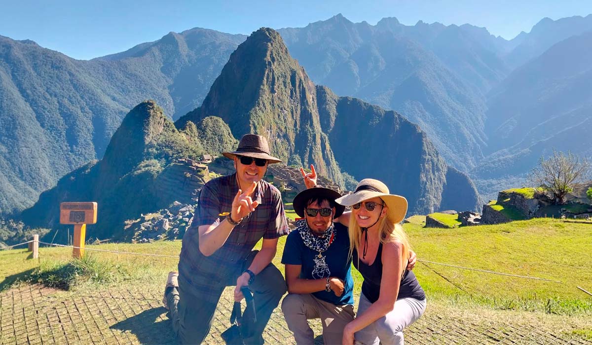
Day 4: Aguas Calientes – Machu Picchu – Cusco
The final day of the expedition begins early in the morning in Aguas Calientes. After spending the night at the hotel, travelers board buses that go up Hiram Bingham Road to the main access point of the Historic Sanctuary of Machu Picchu. The zigzagging bus ride takes about 30 minutes.
Once past the entrance, the standard agency itinerary includes a two- to three-hour guided tour of the Inca citadel. During this time, the group will explore the urban, agricultural, and religious sectors of the archaeological complex while strictly following the regulated circuit shown on their ticket.
After the official tour ends, hikers with the proper permits can explore additional areas. The main options are climbing Huayna Picchu (the steep peak at the back of the site) or taking the route to the Inti Punku ("Sun Gate") sector. Logistically, it's important to note that tickets including entry to Huayna Picchu have limited capacity and must be purchased in advance.
The itinerary concludes with a bus ride back to Aguas Calientes. In the afternoon, travelers board the tourist train to Ollantaytambo (or Poroy) station, where a private vehicle awaits to transport the group to Cusco.
Lares Trek Distances
Day 1: Cusco to Huacahuasi: 12 Km (7.46 miles)
Day 2: Huacahuasi to Patacancha: 17 Km (10.56 miles)
Day 3: Patacancha to Aguas Calientes: 12 Km (7.46 miles)
Day 4: Aguas Calientes to Machu Picchu: 4 Km (2.49 miles)
Total Distance: 45 Km (27.96miles)
Lares Trek Difficulty
The Lares walk is generally considered moderate in difficulty. While it is not technically challenging, the altitude may affect some people.
We recommend bringing a wooden cane to help with balance and reduce stress on your knees while walking the Lares route. Please do not use a cane with a metal tip, as it can damage the fragile environment along the way. You can find more tips for the Lares Trek here.
Lares Trek Altitudes
The highest point you will reach while trekking the Lares Trail is 4,550 meters. The campsites are located at 3,600 meters.
Remember that it is impossible to predict who will be affected by the altitude. The ability to adapt to high altitudes is determined by genetic composition and has little to do with physical condition or health.
Most people will not have problems as long as they acclimate properly. Spend a full day in Cusco (10,650 feet), take it easy, and drink plenty of water; this is usually enough for most people. You can find out more about altitude sickness and pills to prevent it here.
| Day | Altitude | Distance |
| 1 |
Cusco - Calca – Lares - Huacahuasi
|
|
|
|
|
| 2 |
Huacahuasi - Ipsaycocha Lake - Patacancha
|
|
|
|
|
| 3 |
Patacancha - Huilloc - Ollantaytambo - Aguas Calientes
|
|
|
|
|
| 4 |
Aguas Calientes - Machu Picchu - Cusco
|
|
|
|
|
When is the best season to hike the Lares Trek?
The best time to visit is during the dry season, from April through the end of September. In October, the rainy season begins, and Machu Picchu is often covered by clouds. If you travel in June, we recommend booking the Inti Raymi 2026 Tour on June 24th. You should also hike the Palcoyo Mountain Tour to see the incredible Rainbow Mountain in the Andes.
Alternative Treks to Lares Trail
- Inca Trail Tours
- Choquequirao Trek 4 Days
- Salkantay Trek 5 Days
- Machu Picchu 3 Day Hike
- 2 Day Inca Trail Tour
- 2 Day Inca Trail with camping
- Inca Quarry Trail


