

The best hiking routes in Peru go through very different landscapes: snowy mountains over 6,000 meters, deep canyons, volcanoes, high Andean lagoons, and the tropical rainforest. Also, many pass through archaeological sites that can only be reached on foot; because of this and many other things, the country is one of the most complete destinations to visit in South America.
This guide brings together ten routes spread across Cusco, Ancash, Puno, Arequipa, and the Amazon. It includes classic hikes like the Inca Trail and Salkantay, as well as less crowded options like Choquequirao and Ausangate. For each one, you will find what you see along the way, which region it is in, and what type of experience it offers. This way you can compare and choose according to your physical condition and the time you have.
Before choosing, it is a good idea to keep a few points in mind. Most of these routes are best hiked in the dry season, and several exceed 4,000 meters. Some, like the Inca Trail, require a permit and must be booked months in advance. Now we will get to know the best hiking routes in Peru:
1.- Trek the Inca Trail to Machu Picchu (Cusco)
The Inca Trail routes lead to Machu Picchu on foot through sections of original Inca road. It is the best-known hiking route in Peru and ends with the entrance to the citadel through the Sun Gate. The route changes landscape constantly: it goes from the puna to the cloud forest and crosses archaeological sites like Llactapata, Runkurakay, Sayacmarca, Phuyupatamarca and Wiñay Wayna.
Inca trail facts
- Duration: 4 days and 3 nights in the classic version.
- Distance: Between 42 and 43 km.
- Start: Km 82, the official starting point.
- Highest point: Warmiwañusqa Pass (Dead Woman's Pass), at 4,215 m a.s.l.
- Arrival: Sun Gate (Inti Punku) and Machu Picchu.
About permits and booking
For the Inca Trail to Machu Picchu, 500 people per day are allowed on the trail, among tourists, guides, porters, and cooks; therefore, only about 200 are for visitors. Likewise, this permit is only obtained through an authorized agency, and once issued it cannot be changed in name. At the Km 82 checkpoint, the original passport is presented for the start of the hike. It is worth noting that permits sell out between two and six months in advance, depending on the season, so it is important to book ahead of time.
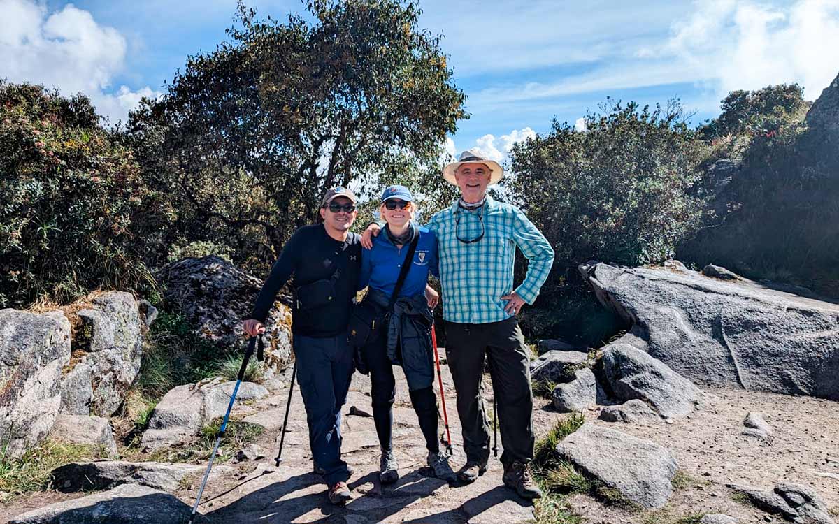
2.- The Ausangate is the most Representative Mountain (Cusco)
The Ausangate trek goes around the snow-capped mountain of the same name, in the Vilcanota Mountain Range. The mountain is in the Ocongate district, Quispicanchi province, and is considered an apu, a protective deity of the nearby towns. The circuit is a high mountain route and combines glaciers, lagoons, hot springs and passes over 5,000 meters; it is an alternative to the Inca Trail for anyone looking for a more demanding route with fewer crowds.
Facts about the Ausangate Trek
- Highest point of the mountain: 6,384 meters above sea level.
- Duration: The full circuit takes 4 or 5 days. The route is circular and can be hiked clockwise or counter-clockwise.
- Start: Tinqui, about 3 hours by road from Cusco.
- Highest pass: Palomani, at 5,200 meters above sea level.
- Level: Demanding, due to the altitude and consecutive passes.
- Versions: Day trip to the 7 lagoons and 3, 5, and 7-day circuits.
Ausangate is also a pilgrimage site. Every year thousands of walkers arrive at the sanctuary of the Lord of Qoyllur Rit'i, a celebration recognized by UNESCO as Intangible Cultural Heritage of Humanity since 2011.
On the other hand, if you plan to do this hike, let it be known that the dry season, from May to September, offers clearer skies and more stable weather. The nights of June and July can record frosts of up to −10 °C, so the sleeping bag and thermal clothing are essential.
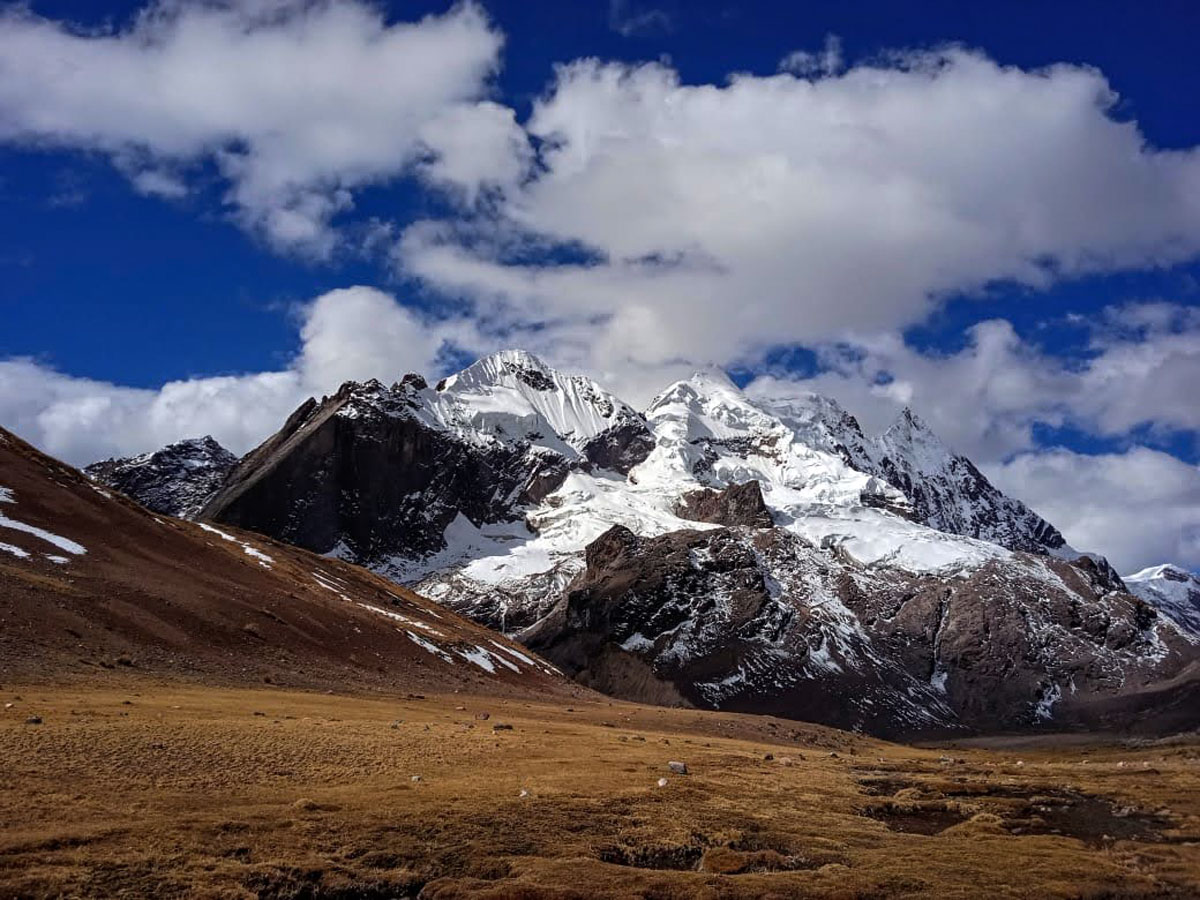
The Ausangate trek is one of the most attractive in Cusco.
3.- Pastoruri Glacier: the climate change route (Áncash)
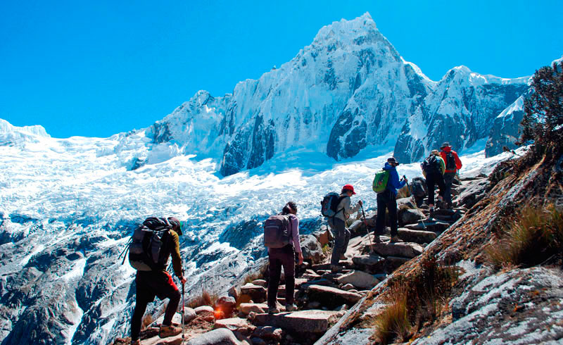
The Pastoruri Glacier is in the south of the Cordillera Blanca, inside the Huascaran National Park, in the Callejón de Huaylas (Áncash). The park was named Natural World Heritage in 1985. The visit to this glacier is not a multi-day trek, it is a one-day trip from Huaraz, with a short walk to the base of the glacier, and one of the visits that best shows how glaciers are shrinking in Peru.
Facts about the Pastoruri Glacier
- Location: South of the Cordillera Blanca, inside the Huascaran National Park.
- Altitude: The glacier starts at about 5,201 m and goes down to 5,001 m.
- Duration: A full day, about 6 hours round trip by bus from Huaraz.
- Hike: Between 40 minutes and 1 hour from the parking lot to the glacier.
- Difficulty: Low in physical effort, but the height above 5,000 m can be hard without getting used to it.
Pastoruri has less than 2 km² of surface left. It lost more than 50% of its ice since the seventies. Access to the tourist area was stopped in December 2007 for safety. Since 2011 it works as an interpretive circuit, where the "climate change route" is shown, with talks by park experts.
RELATED: Peru Treks and Adventure
4.- The trek in Llachon and Ticonata (Puno)
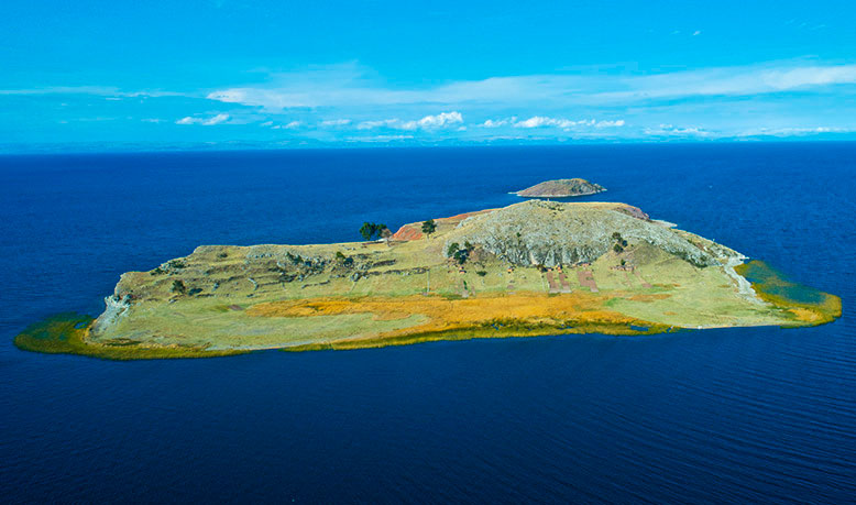
Llachon is a small village on the Capachica Peninsula, on the southern shore of Lake Titicaca. In front of the peninsula is Ticonata Island. Both destinations are an alternative to the busiest routes of the lake, with landscapes of farming terraces, sandy beaches, and paths between communities. Here tourism is experiential and community-based, visitors can stay in family homes and take part in local activities.
Facts about the Hike
- Location: Capachica Peninsula, Capachica district, Puno province.
- Altitude: Llachon is at about 3,820 meters above sea level, on the shore of the lake.
- How to get there: From Puno it is about 1 h 30 by road or by boat. Some tours combine the trip with a visit to the Uros.
- Usual duration: Day trip or 2 days.
- Difficulty: Low to moderate, with walks around the village.
About Llachon
The village is known for its rural community tourism, with lodging in family houses. Visitors can walk between farm fields and natural viewpoints, and take part in farming, artisanal fishing, and craft workshops. The peninsula also has several calm beaches on the lake shore. Boats to Taquile, Amantani, and the Uros leave from Llachon, with fewer tourists than departures from Puno.
About Ticonata Island
Ticonata, also spelled Tikunata, is in front of the Capachica Peninsula. Its inhabitants are originally from the Ccotos community. It is reached by boat in about 20 minutes from Ccotos or 40 from Chifron. The island has traditional houses, small beaches, a viewpoint, and trails among farming terraces. Its inhabitants live on fishing, potato farming, and community tourism.
RELATED: What is a great place to go trekking hiking in Peru?
5.- The trek the Colca Canyon (Arequipa)
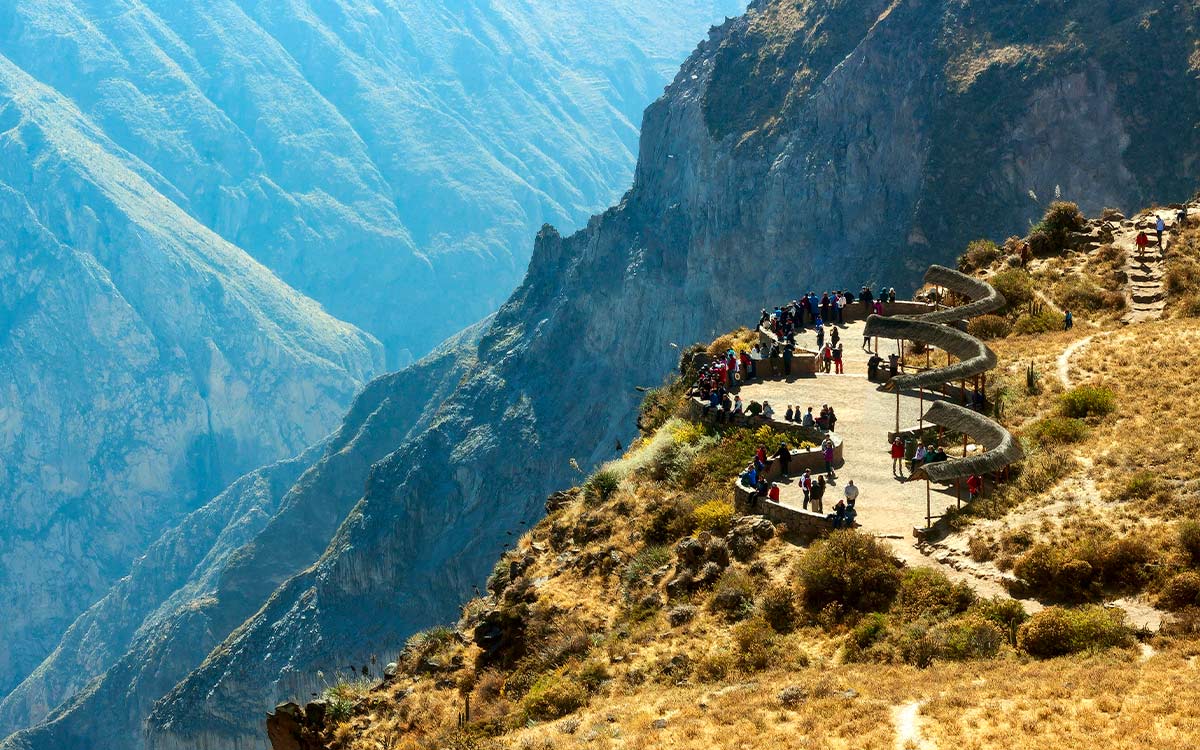
The Colca Canyon is north of the city of Arequipa, in the province of Caylloma, and the Colca river runs through it. The valley was formed by a geological fault that the river eroded over millions of years.
The canyon trip is interesting not only for the landscape, but also for the farming mastery of the area, with many terraces, colonial architecture, and picturesque towns along the way. Visitors can enjoy natural landscapes and local wildlife, like herds of vicuñas, llamas and alpacas, and bird species like the giant hummingbird, eagles, geese, and the Andean condor.
Facts about the Colca Canyon
- Location: Province of Caylloma, about 3 to 3.5 hours by road from Arequipa.
- Duration: The classic trek is 2 days and 1 night; there are also 3-day versions.
- Altitude: The Cruz del Condor viewpoint is close to 3,800–4,000 m; the trek goes down to the Sangalle oasis, at about 2,100–2,200 m.
- Difficulty: Moderate to demanding, especially on the final climb from the bottom of the canyon.
Good physical shape and no breathing problems are recommended, since the return involves a steady climb from the bottom of the canyon. The entrance to the Colca valley is paid separately, and the hot springs have an extra cost.
6.- Explore the Peruvian Jungle Forest (Puerto Maldonado, Iquitos and Manu)
This adventure in the Amazon mixes walks through the jungle with boat trips along the Tambopata river. The most famous destination is the Tambopata National Reserve, in the department of Madre de Dios, famous for its clay licks: clay walls on the riverbank where dozens of macaws, parrots, and parakeets gather every morning to eat minerals that help them digest their diet.
Facts about the Tambopata jungle
- Location: Tambopata National Reserve, Madre de Dios, with access from Puerto Maldonado.
- How to get to Puerto Maldonado: By road from Cusco (about 10 hours) or on a direct flight; the Interoceanic Highway also exists.
- Chuncho Clay Lick: The most visited one, about 5 hours by boat from Puerto Maldonado. It can be seen on a one-day trip.
- Colorado Clay Lick: Further away, about 12 hours by boat, so it usually includes a night in a nearby lodge. It is considered one of the largest clay licks in the Peruvian Amazon.
- Best time to see the birds: Between 5:30 and 9:00 in the morning.
If you take a trip to this place, it is necessary to hire operators authorized by SERNANP, since the reserve is a protected natural area. On the other hand, the dry season (May to October) usually offers better conditions for watching wildlife.
RELATED: Best time of year to visit Peruvian Amazon

7.- The Trek the Salkantay Mountain (Cusco)
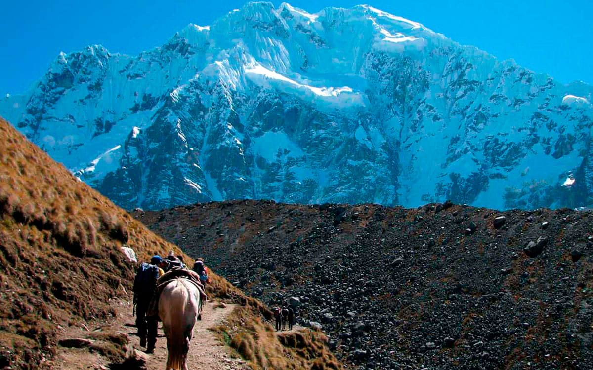
Salkantay is located in the Vilcabamba Mountain Range and reaches 6,271 m.a.s.l. It is the main snow-capped mountain of the range and one of the most important Apus of Cusco. The Salkantay trek is the most popular alternative to the Inca Trail: it crosses high mountain passes, cloud forest, and high jungle, and gets to Machu Picchu through Hydroelectric and Aguas Calientes.
Facts about the Salkantay Trek
- Duration: 5 days and 4 nights in the classic version.
- Total distance: About 72 km, spread across sections of between 12 and 22 km per day.
- Highest point: Salkantay Pass, at 4,650 m.a.s.l.
- Start: Mollepata, about 100 km from Cusco.
- Level: Moderate to demanding. It is longer and has more slope than the Inca Trail, although it does not require technical mountain experience.
To do this hike, it is important to keep in mind that the Salkantay pass is over 4,600 m, so it is a good idea to get used to the altitude for a few days in Cusco before starting. It is possible to combine this route with the short Inca Trail or with Choquequirao for those looking for a longer trip.
8.- The Ascent to the Misti Volcano (Arequipa)
The Misti is the most iconic volcano in Arequipa and dominates the landscape of the city. It is an active stratovolcano, made of ash and lava. The climb does not need mountain technique, but it does demand good physical fitness because of the altitude and the terrain. Thanks to its past eruptions, the region has fertile land for farming, like the Chilina valley, lived in since before the arrival of the Spanish in 1540.
Facts about the Misti volcano
- Altitude: 5,822 m a. s. l
- Location: Between the districts of Miraflores and Chiguata, inside the Salinas and Aguada Blanca National Reserve.
- Duration: 2 days and 1 night on most routes.
- Level: Physically demanding because of the altitude.
- Best time: From May to November, in the dry season.
The only technical difficulty is the volcanic ash and sand, which in some sections forms dunes and makes the climb more tiring. Sturdy footwear, trekking poles, and warm clothing for the night at the camp are recommended. In winter there can be some snow near the summit, where crampons are occasionally needed.
To do this hike, it is recommended to hire a local guide, the routes are not marked and the guide takes care of the gear, meals, and logistics. It is important to arrive in Arequipa with a few days of getting used to the altitude before the climb.
9.- The Trek to Choquequirao (Cusco)
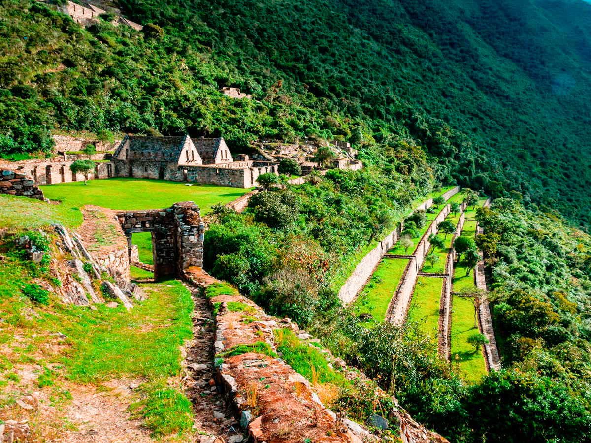
Choquequirao, known as the Cradle of Gold or the sacred sister of Machu Picchu, stands on a hill at about 3,050 meters above sea level. Its stone walls do not have the refined finish of the temples of Machu Picchu, but the mark of the Inca engineers is unmistakable. Unlike Machu Picchu, which receives thousands of visitors a day, Choquequirao remains one of the least crowded Inca archaeological sites in the country.
Facts about Choquequirao
- Site altitude: About 3,050 meters above sea level.
- Starting point: Cachora, Abancay, about 4 hours by road from Cusco.
- Distance: About 30 km each way from Cachora.
- Duration: The classic trek is 4 days, although there are also 5-day versions and 8-9 day combinations all the way to Machu Picchu.
- Level: Very demanding. The route goes down and up almost 2,000 meters of elevation change in both directions, crossing the Apurimac canyon.
About the Choquequirao archaeological complex
The site is organized into several sectors, among them the political-religious center, the system of springs and channels with aqueducts, and the set of agricultural terraces, which are very well preserved. The architecture is distributed around a main plaza, and the remains are grouped into separate districts according to their function and social rank. Sources do not agree on the exact number of identified sectors.
Also, Choquequirao is in a low mountain area, northwest of the Apurimac canyon. It has a unique ecology, with abundant vegetation and a climate that alternates between hot and cold, which supports the diversity of flora and fauna in the area.
10.- The Trek to Espiritu Pampa to Choquequirao (Cusco)
The archaeological site of Choquequirao was part of the complex system of Andean towns of Vilcabamba, Espiritu Pampa and New Vilcabamba in Inca times, connected to Machu Picchu through an intricate network of trails. This route is one of the still unexplored ones. More and more people explore the landscape and, besides, have a closer contact with the Andean people, who wear very typical and unique customs in the world.
This is a quite exhausting route between jungle and Andean vegetation, visiting archaeological sites like Lucma, Rosaspata, Nusta Hispana and towns like Yupanca, Concevidayoc and Vilcabamba, to end at the ruins of the lost city of the last governor Manco Inca.
Facts about the Trekking to Vilcabamba
- Location: La Convencion Province, northwest of Cusco, in the edge of the jungle.
- Access: By road from Cusco to Huancacalle, about 7 to 9 hours.
- Duration: Between 4 days (only to Espiritu Pampa) and 7 days for the full circuit; some variants reach 15-16 days combined with Choquequirao and Machu Picchu.
- Altitude: It varies between about 500 m in the jungle zone and over 4,300 m in the Andean passes the route crosses.
- Level: Very demanding, due to the duration, the change of ecological floors, and the changing weather.
For a trip to this destination, the dry season, from May to September, is recommended. Also, it matches the high season of the Inca Trail, but on this route it is rare to cross paths with more than a handful of other walkers.
Other Treks in Peru
Many are the routes in Perú, but none is like the Inca Trail, the most famous pedestrian path in the Americas. After flying from the capital of Perú, Lima, you will arrive in Cusco to walk for four days along a path through forests and dense fog, millenary stone steps and discovering the ruins of ancient fortifications and Inca cities, and all the time enjoying majestic views.
- Salkantay Trek to Machu Picchu 5 days
- Hiking the Inca Trail to Machu Picchu 5 days
- Inca Quarry Trail 4 Days
- 2 Day Inca Trail Tour
- 2 Day Inca Trail with Camping
- 3 Day Inca Trail
- Vilcabamba Hike to Machu Picchu 6 days
- Choquequirao trek to Machu Picchu 9 days
- Ausangate trek 7 days
If you want to visit Machu Picchu, we recommend you to book your Machu Picchu Ticket in advance, so you will enjoy your Vacation in Machu Picchu without any problem.
When is the best time to hike in Perú?
The best season is during the dry season, which covers the months April to the end of September. In October the rains begin and you can find Machu Picchu covered by clouds. If you travel in June, we recommend you to book the Inti Raymi 2027 Tour that takes place in June 24th, and also hike the Palcoyo Mountain Tour, which is an incredible Rainbow Mountain located in the Andes.


