
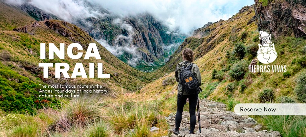
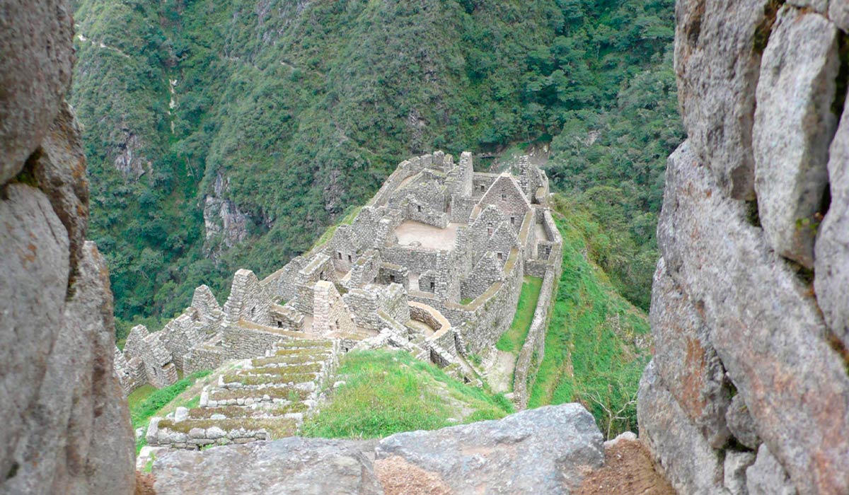
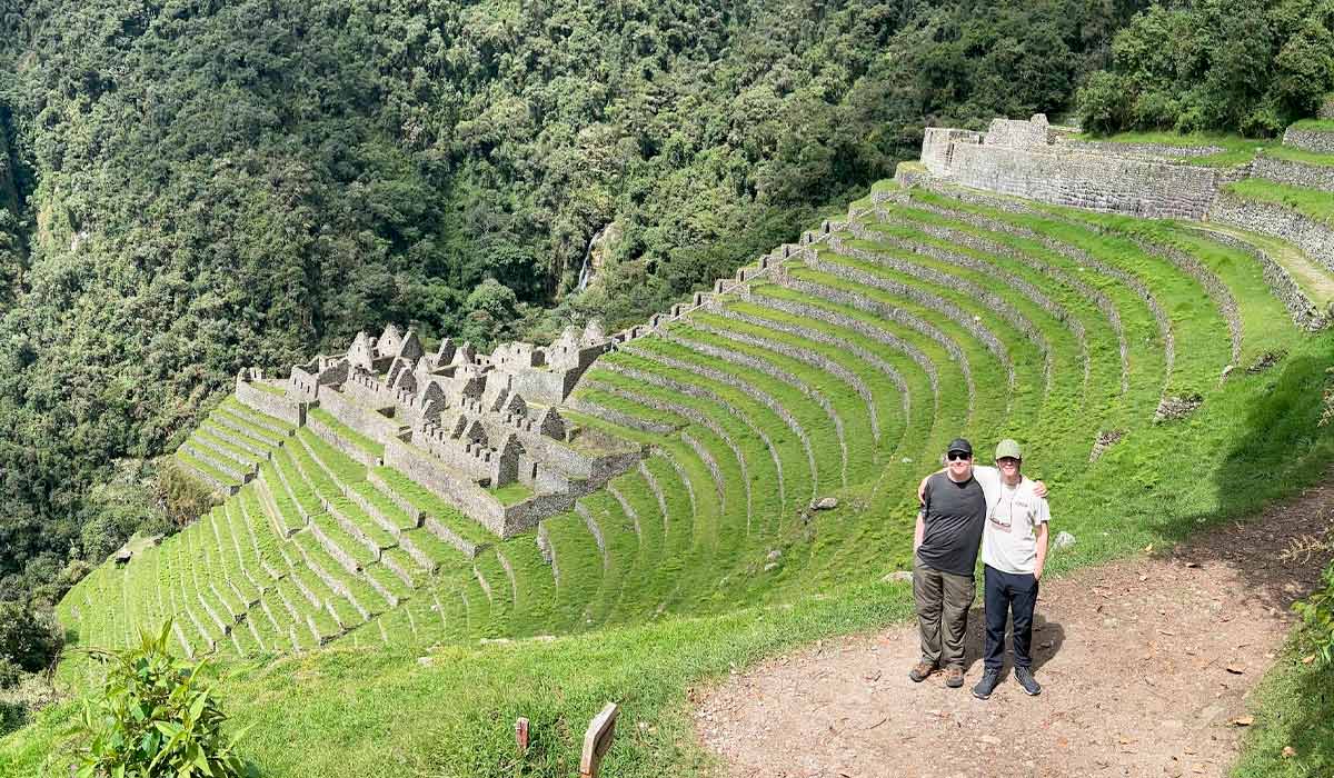
Discover the breathtaking architectural masterpiece of Wiñay Wayna, the grand finale of the classic Inca Trail before reaching Machu Picchu. Perched precariously on the steep eastern slopes of the Peruvian Andes, this stunning archaeological complex features dramatic agricultural terraces plunging 900 meters down to the Urubamba River.
Winay Wayna is more than just a technical checkpoint or campsite; it is an exclusive destination. It is accessible only by foot and requires a highly sought-after Inca Trail permit, advanced planning, and physical acclimatization. Why is this site often considered even more beautiful than the citadel itself? Read on to uncover the secrets of the "Forever Young" ruins.
Technical and geographic facts about Wiñay Wayna:
- Topographic Altitude: 2,650 meters (8,700 feet) above sea level.
- Weather conditions: It has a subtropical climate, which is characterized by warmth and high humidity levels typical of the jungle brow. The weather cycle records constant rain from December to March.
- Access routes: Entry is strictly for walking and is regulated. Logistically, entry is only possible with permits for the Classic Inca Trail or the two-day Inca Trail short route.
- Etymologically: The Quechua word Winay Wayna translates to "Forever Young" in English. This modern name was given in the 20th century by archaeologist Julio C. Tello and refers to a local type of orchid that blooms year-round on the walls and terraces of the archaeological complex.
- Location: The site is located five kilometers (three point three kilometers in a straight line) southeast of the main citadel of Machu Picchu. Along the active route, it sits exactly between the Phuyupatamarca archaeological complex and the Intipunku (Sun Gate).
Winay Wayna Ruins, Peru
Built during the imperial period under the rule of Inca Pachacutec, this archaeological complex is notable for its landscape-adapted engineering. The site covers a steep mountain slope and its layout copies the urban planning of Machu Picchu on a smaller scale.
The complex is technically divided into the following sectors and features:
- Agricultural and Support Sector: Due to the lack of flat land in the geography of the Andes, the slopes were modified through a large system of terraces. These platforms served two technical functions: preventing soil erosion from the high jungle rains and functioning as large-scale agricultural production centers for growing corn, potatoes, quinoa and coca leaves.
- Urban Sector ("Kancha" System): The living and administrative areas are organized according to the Inca urban pattern of "kanchas," which are buildings grouped around a central courtyard similar to a condominium. These buildings served as administrative offices, residences and colcas (storehouses for crops).
- Stone Architecture: The structures are built with granite blocks. They maintain classic imperial architectural features, such as trapezoidal doors, windows, and niches. The main gate has a double jamb design, indicating high status, while the other entrances have single jambs. The walls still have stone gables and tying rings that held the slanted straw roofs.
- Ceremonial Water Engineering: Along the central axis of the site, on a steep incline, is a series of religious fountains and ceremonial baths. These granite structures continuously channel water, demonstrating the builders' mastery of water engineering. The logistical connection to Machu Picchu begins at the exit point of Wiñay Wayna, where the landscape of the Inca Trail changes. The path becomes mostly level and easier to walk on. It ends with a series of long stairs that lead directly to the Inti Punku ("Sun Gate"), the original entrance to the citadel.
Information about the Wiñay Wayna base camp:
The Wiñay Wayna campsite is the third and final official overnight stop on the classic Inca Trail route. It is located 10 kilometers from the previous campsite at Chaquicocha and only 4 kilometers from the Inti Punku ("Sun Gate").
- Infrastructure and Safety: The designated tent area is prepared to handle continuous traffic. To ensure stability against the landscape and rainfall of the high jungle, the platform features over 125 square meters of retaining walls.
- Route Strategy: Its proximity to the final archaeological site enables hikers to begin their journey in the early morning hours. The logistical objective of this camp is to facilitate an early arrival at Inti Punku to coincide with sunrise and offer the first panoramic view of Machu Picchu.
- Operational availability: Due to its privileged location, high demand, and strict load capacity, securing this camp is not guaranteed. Spaces are distributed directly by the Ministry of Culture when processing government permits.
How do you get to Wiñay Wayna?
Access to the Winay Wayna archaeological complex is restricted to the walking trails of the regulated Inca road network. There are no free access routes. To enter, you must travel with a certified guide and have the proper government permit.
There are two official logistical routes to reach the site:
- Classic Inca Trail Route (4 days/3 nights): Arrive at Winay Wayna Peru, during the afternoon of the third day of the expedition. This traditional route begins in the town of Piscacucho (Km 82) and passes through various geographic and historical areas, such as Cusichaca, Huayllabamba, and Phuyupatamarca, before reaching the site.
- Short Inca Trail Route (2 days/1 night): It is the fastest and most direct route. It requires taking the train and getting off at kilometer 104 of the railway. From the Chachabamba checkpoint, a continuous and demanding climb of about 3.5 to 4 hours begins, ending at Wiñay Wayna. Agencies usually sell this option as the "Two Day Inca Trail" or the "One Day Inca Trail" (one day of hiking and one day of touring the citadel).
The Inca Trail to Winay Wayna and Machu Picchu
Built on a steep slope, it offers a view of the Urubamba River, located 900 meters away as the crow flies. To reach the river, walk 400 meters northwest to the Wiñay Waina camp, where the path connects with the Inca Trail. From there, the trail descends 2.3 km to the river in a series of zigzags. There is an archaeological site there where the Inca Trail skirts the river for 0.6 kilometers to a river dam. About 0.8 kilometers later, the road forks, beginning the 0.9-kilometer ascent to Inti Punku and continuing 1.8 kilometers to the entrance of Machu Picchu.
The distance between Wiñay Waina and Machu Picchu is 7 km on foot.


