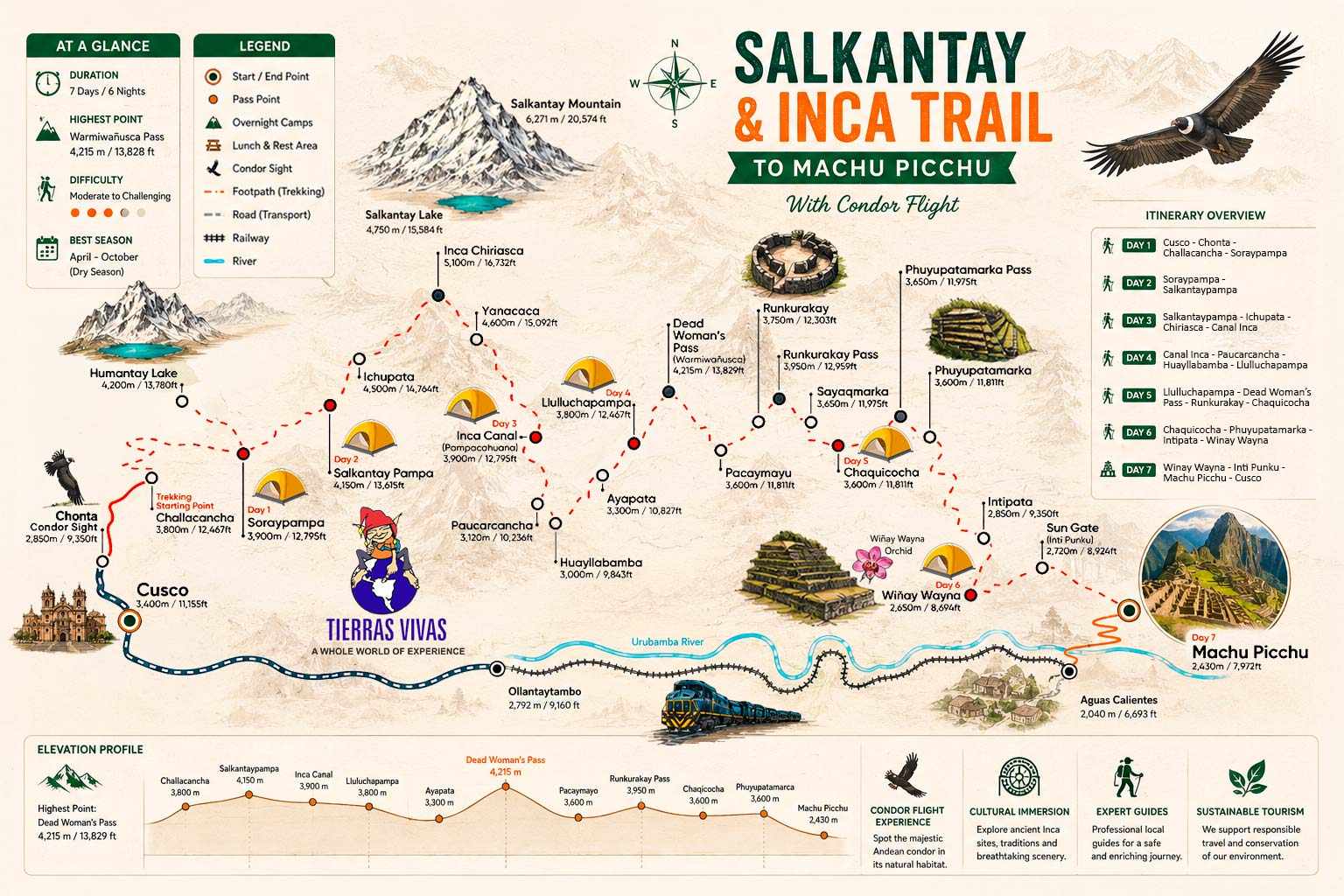
Salkantay Inca Trail Condor Flight


Description
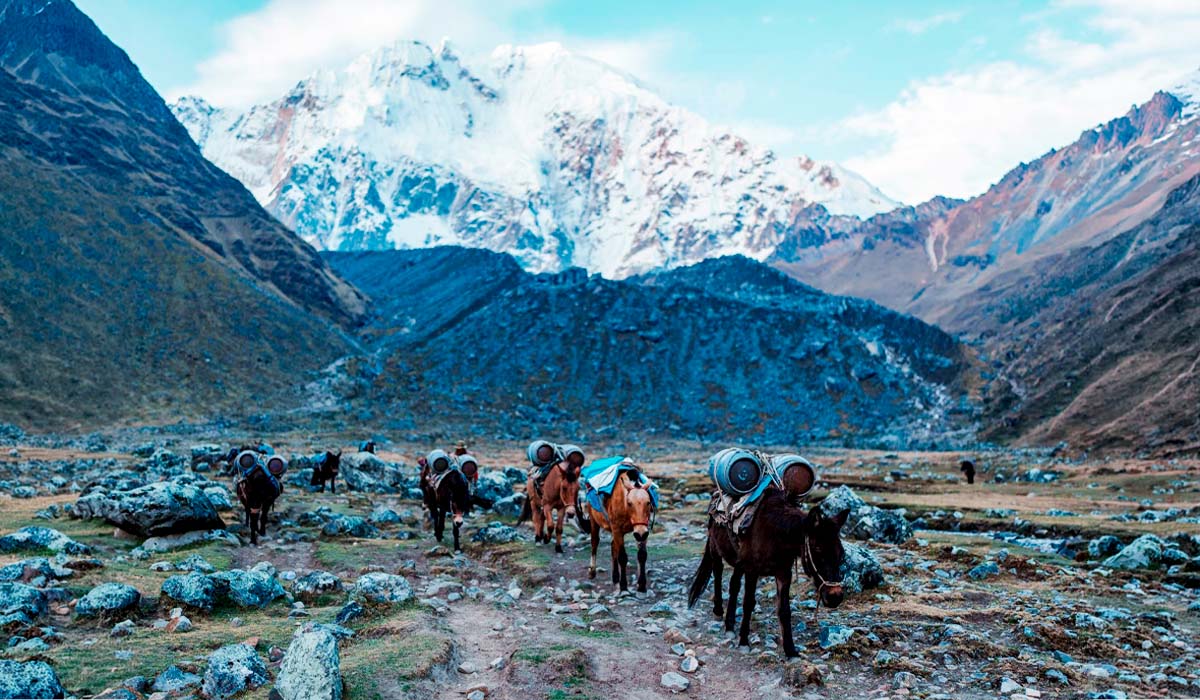
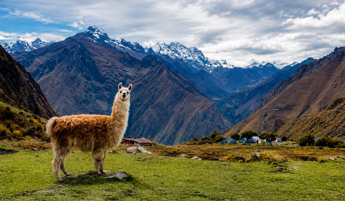
This is a new alternative hike to Machu Picchu and most complete of the Inca trail, involves 7 day hike to the Classic Salkantay to Inca Trail and includes to view of the traditional Andean birds - Condors, Driver to Chonta and hike on a mountain trail through breath taking sceneries led us to the panoramic viewpoint where we were more than rewarded with even more spectacular views of the deep gorge and the mountains around. Some eight individual condors were soon soaring upwards, coming closer and closer, some gliding only a few meters over our heads. An authentic Andean journey to "Savage Mountain", which is the translation for Salkantay, which may be attributed to the clouds which hang from the jungle lowlands and encompass the peak. At a height of 6271 MAMSL (20,573 ft) Nevado Salkantay the tallest summit in the Cordillera and one of the tallest in the Andes, is the starting point for the hike. This has become popular with hikers who want a more peaceful, less walked path and includes a visit to the Inca ruins of Machu Picchu. For the first 4 days you will be surrounded by glorious landscapes and won’t see many other groups and. On the third day you will connect to the Inca Trail and continue towards Machu Picchu where you will be arriving early on the seventh day. This hike is just a little more challenging than the Inca Trail. Horses are used for the first 4 days to carry food and equipment until you join the Inca Trail where you swap horses for porters (horses are not allowed on the Inca Trail). Trek permits are necessary for this tour so it’s important to reserve months in advance.
What to Expect
Tour Overview
Sustainable Tourism: At Tierras Vivas, we are happy to promote and practice sustainable tourism by being eco-friendly and supporting local communities. We are again supporting Sernamp this Inca Trail with picking up trash and clearing the trail
Crew: A Tierras Vivas Representative in Cusco and a professional Tour Guige, a Cook, a Horseman and Porters for the Salkantay Trek vs Inca Trail to Machu Picchu.
Accommodation: Campsites (6 nights).
Meals: 6x breakfast, 6x lunch, 6x dinner, 6x afternoon tea.
Transportation: Transportation by private van, 1x train
Group Availiable: Mix: 2 Max: 8 Trekkers
Quick Itinerary:
Condor + Salkantay trail
Day 01: Cusco - Chonta - Condor Sight - Sayllapata
Day 02: Sayllapata - Salkantay Pampa
Day 03: Salkantay Pampa - Pampacahuarina
Inca Trail
Day 04: Pampacahuarina - Llullucha Pampa
Day 05: Llucha Pampa - Chaquicocha
Day 06: Chaquicocha - Wiñayhuayna
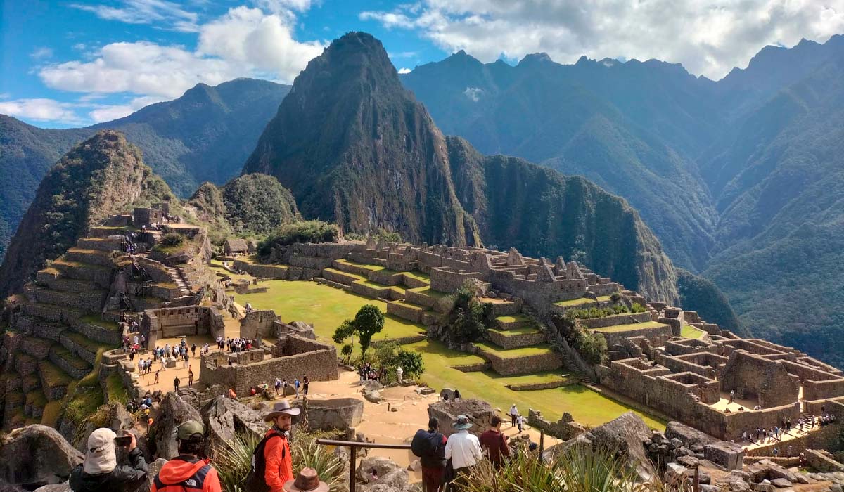
Day 07: Wiñayhuayna - Machu Picchu
Highlights of the Condor Sight Salkantay Inca Trail:
- Discovery of a more complete Incan path
- Opportunity for experienced trekkers to enjoy a challenging hike
- Trekking to the sacred Salkantay Mountain
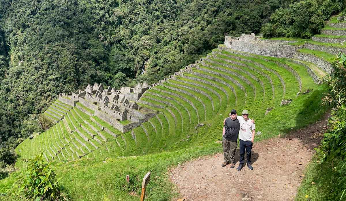
- Hike the Classic Inca Trail
- 7 day hike with a professional bilingual Tour Guide
- Lovely mountain landscapes observation
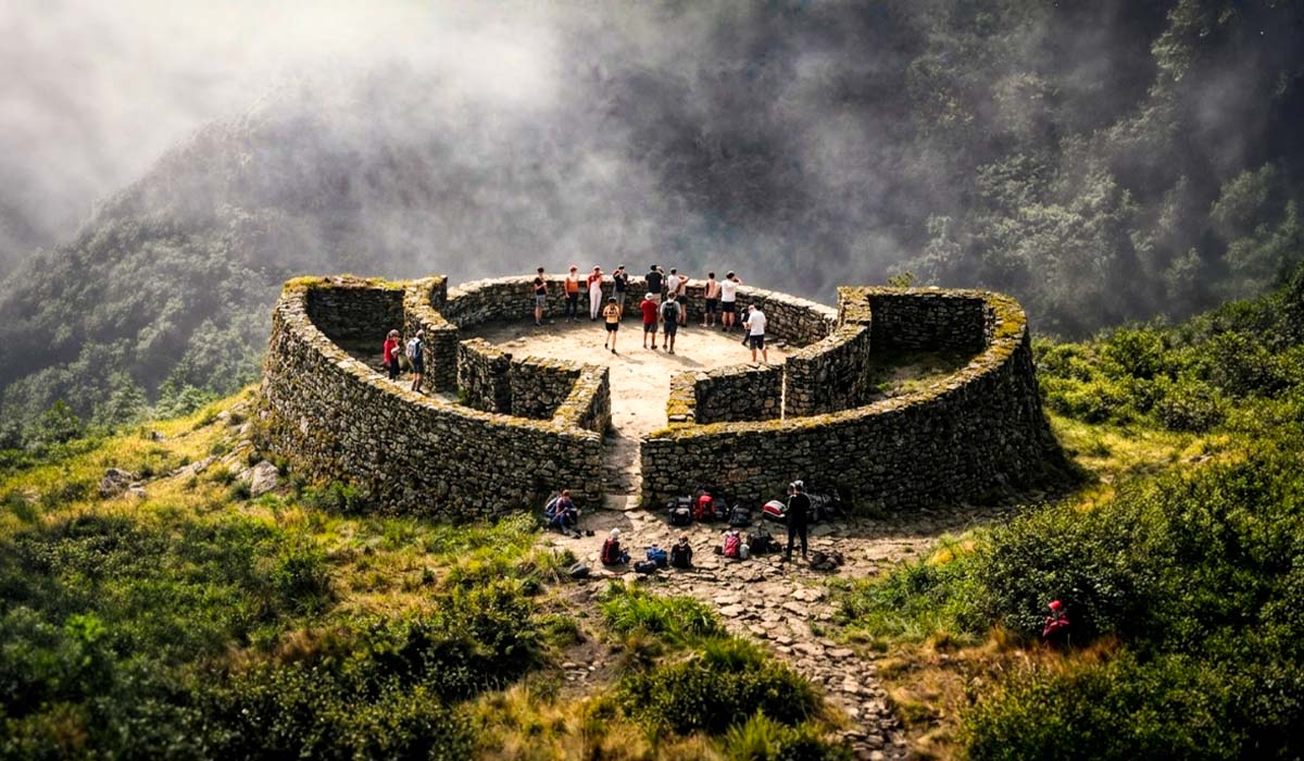
- Amazing and hidden Incan sites discovery
- View the enigmatic Condor overflight
- Guide tour of the Condor sight
- Guide tour of the Salkantay and Inca Trail
- Guided tour of the amazing Inca citadel - Machu Picchu
Book Now! the Salkantay Inca Trail Condor Sight 7 Days with us and discover the best alternative and complete Inca route. Visit our videos of the Salkantay Inca Trail condor reviews
How to book the Salkantay Trek to Inca Trail with Condor Sights?
Please note: The Inca Trail starts on the fourth day of the Salkantay trek Inca Trail tour Condor Sights! (For example, if you like to start the tour on the 10th of July, you need to check Inca Trail availability of the day 13th of July!) If there is still availability of the Inca Trail on your date requested in the time of your book online. Once booked, we require the pre-payment (Please note that an Inca Trail booking is valid only for 1 hour!! If it is not paid within).
Salkantay IncaTrail Alternative Tours
- Salkantay Inca Trail 7 Days
- Choquequirao Machu Picchu hike
- Salkantay and Condor Sight 5 Days
- Salkantay to Machu Picchu 5 Days
- Classic Inca Trail 4 Days
Salkantay Inca Trail Advisor
Itinerary Details
Day 1: Cusco - Chonta - Condor Sight - Humantay - Soyrapampa
We drive from Cusco by bus to Chonta, we travel through the highlands of Anta. A dirt road will take us over the Puna highlands to the scenic mountain hamlet of Chonta near the Apurimaq Canyon. A 3km trek along the mountainside brought us to the Condor viewing platforms and the view of the canyon (double the depth of the Grand Canyon in places) and Apurimac river way down below is extraordinary. We will be 2 hours to see the condors and - some flying right overhead!.
Continuing our tour, we drive to head trail, Challacancha, where our hike begins. We start trekking up to Tillka from where we take the road to Marcocasa (3,500 m/11, 482 ft) passing forests and steppes on the route. We can enjoy beautiful vistas of the snow capped peak of Rayuska (5,350 m/17,552 ft). Finally we get to our first campsite at Soraypampa (3,600m/10,200 ft), lunch.
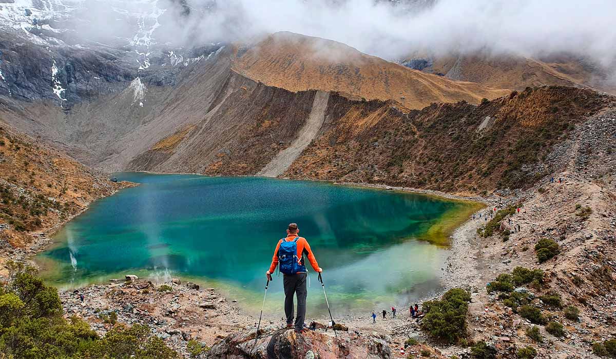
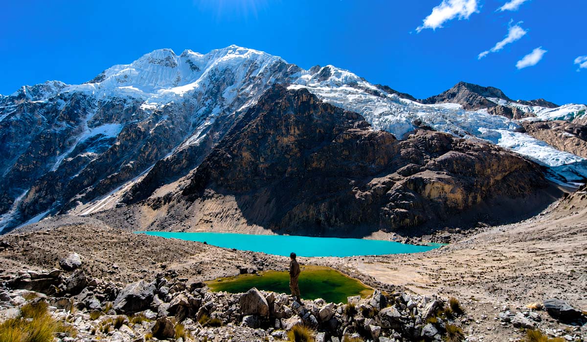
After lunch we will climb the Humantay Mountain for 2 hours to visit the Humantay Lake, a superb lake in the mountains and we then descend back to camp at Soraypampa. There you will find the dining tent set up for afternoon tea with tea, mate de coca, coffee, chocolate etc. You can rest and later are served dinner.
TECHNICAL DETAILS OF THE DAY
- Estimated Trekking Time: 7 hours
- Condor Sight: 2 Hrs
- Trekking Distance: 14 Km
- Max. Elevation: 3,600 m (10,200ft)
- Min. Elevation: 2,803 m (9, 196 ft)
- Difficulty: Easy
Day 2: Soraypampa - Salkantay Pampa
Day 3: Salkantay Pampa - Pampacawana
Day 4: Pampacawana - Llullucha Pampa
Day 5: LLlucha Pampa - Chaquicocha
Day 6: Winay wayna
Day 7: Machu Picchu
Included
What is included in this trek?
Not Included:
Essential Information
Extra services for Salkantay Inca Trail Condor Sight
Luggage for Salkantay Inca Trail Condor Sight trek
Sugget Items
Salkantay Inca Trail Condor Flight Map