As loads of people like to do this hike, the Peruvian government has restricted the availability of the Inca Trail in order to protect the path. Now, 500 people are allowed on the trail per day including approx. 180 tourists and the rest represent the staff (Guides, Cooks, Porters). If you would like to hike it, you need to check the number of spots of the Inca Trail available and book your trail as soon as possible.
Due to these restrictions, we advise you to book it at least 3 months in advance if you like to go between October in January to avoid disappointment. In case, you prefer to trek it between the months of March and September, you should do booking more than 6 months beforehand, as this period falls to the so-called high tourist season and permits sold out quickly.
Inca Trail Highlights
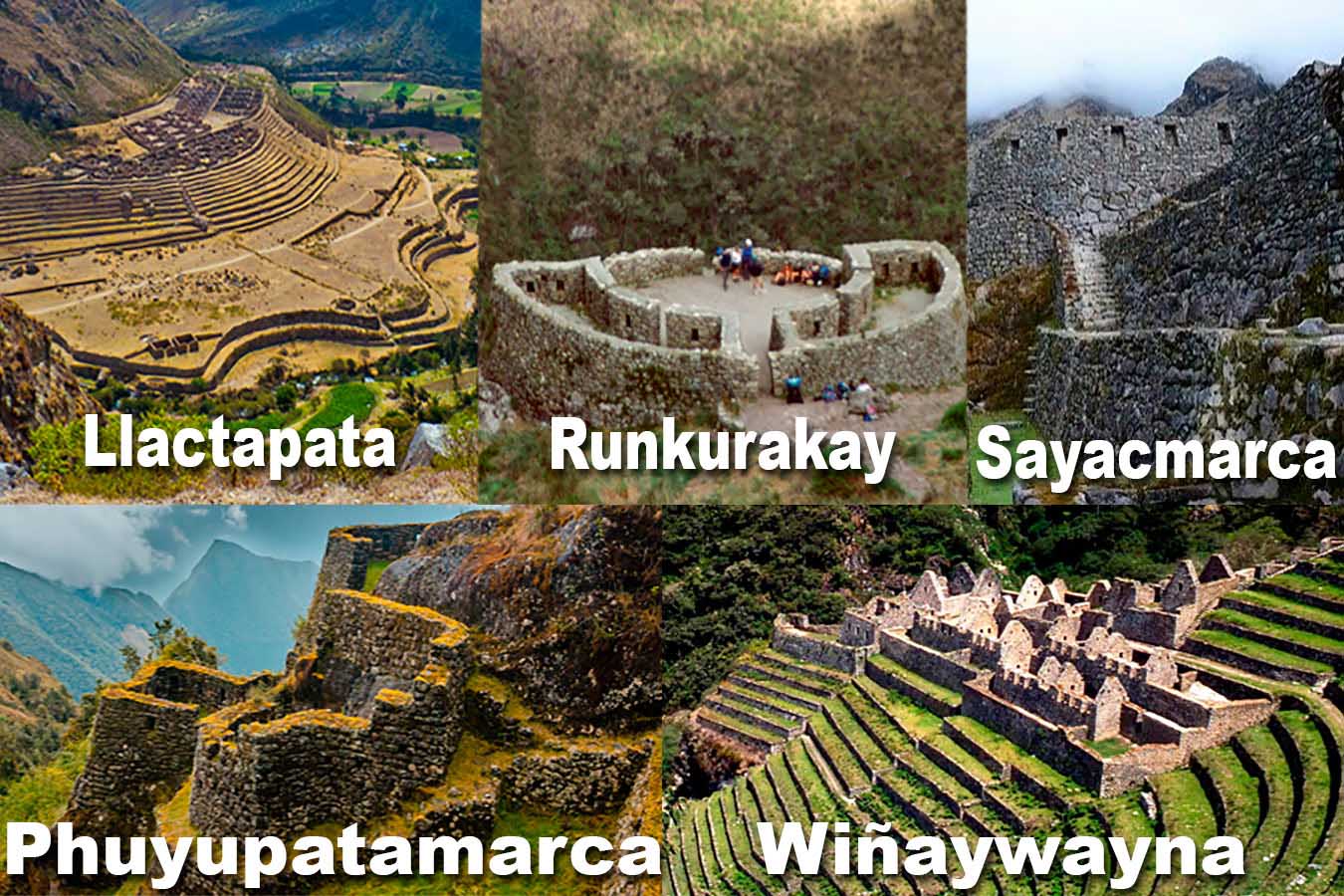
One of the main highlights along the trail is the ancient system of settlements made in granite rock by the Incas, like Wiñay Wayna and Phuyupatamarca, immersed in irresistible natural surroundings. Scores of orchid species, multicolored birds, and dreamlike countryside provide the perfect scene for a path that all trekking fans would love to experience.
Description of the Inca Trail
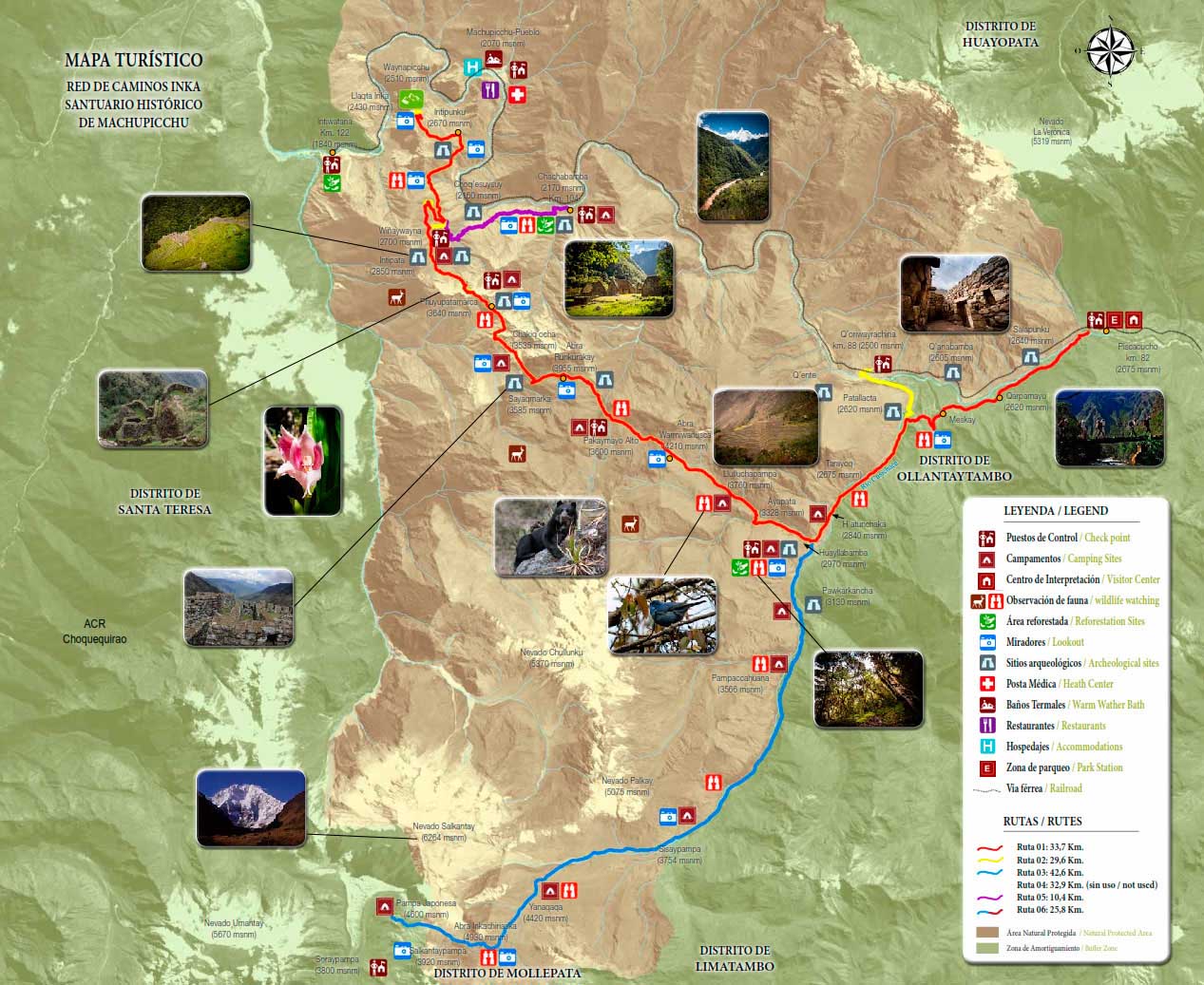
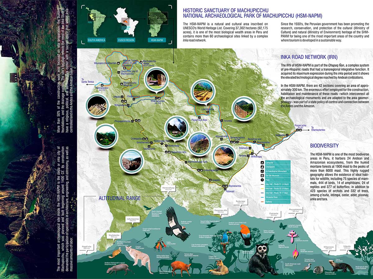
The total distance of the route is about 44 km, starting at km 82 in Pisqacucho. After your briefing, you begin the trek by crossing a bridge (the checking point) to later walk along its left shore through a peaceful eucalyptus garden.

Soon after, you come across the archaeological sites of Llactapata and Patallacta. From there, the trail continues to the left of the Kusichaca River Canyon where you get over a bridge and see Inca tombs, aqueducts, terraced roads, and a canyon. You carry on until the small town of Wayllabamba and Inca aqueducts. In the afternoon, we reach the village of Llulluchapampa. It takes about 7-8 hours to get to this point (17 km). We camp here on the first night. The second day is the hardest, but one of the most fascinating days since you reach 4,200 metres, overcoming the first and highest pass of Warmiwañusqa. If you feel the effects of altitude when crossing the mountain pass, it is best not to stop or descend quickly to the Pakaymayu River Valley, where you have lunch. Later, you are rewarded for the effort as you continue hiking through the valley to see the interesting Inca ruins of Runkuraqay, fenced with niches, which could have served once as a little resting site, guard posts, or ceremonial places. Then, you climb up to the second pass of Abra Runkuraqay, situated at 3,800 metres above sea level. After that, you descend to Yanacocha (Black Lagoon) and then trek up following stone steps to arrive at another cluster of distinct buildings. This location is called Sayacmarka, a pre-Hispanic site with slender streets and buildings that stand at different levels; sanctuaries, courtyards, canals, and an external protective wall. From the top of the arch end, you can see various buildings that look like they once were temples and an astronomic watchtower with a constant water supply and superior food storage.
Sayaqmarka is a location brimming with mysteries and enchantment. Its rough distance from Runkuraqay is about 5 km taking about 2 hours. This site is located over 3,600 meters above sea level. There are a wonderful trail and a tunnel traversing across the site. This night, we camp at Chaquicocha.
The trekking distance of the whole day is 12 km and it takes about 7-8 hours of hiking.

The third day is shorter, only 5 km. We walk past beautiful subtropical vegetation and great archaeological sites. We get over the Phuyupatamarca Pass and just behind it, there are the Phuyupatamarca ruins that are better preserved than the ones we have seen up to now. A few kilometres down is a steep descent taking us via a cloud forest to the last campsite at Wiñay Wayna Visitor’s Centre where you can purchase food and beverage as well as use restrooms.
The fourth day begins at 5 am when we hike the last 4 km to Machu Picchu. Continue along the path, which is clearly marked by signposts (and be careful not to wander too close to the edge of the cliff). Cherish your time on the most valuable masterpiece of the continent! You have plenty of time to be spent at Machu Picchu.
If you go straight from the town of Aguas Calientes, it is only 2 km from the Puente Ruinas station to Machu Picchu. It takes about 20 minutes to go down a narrow path, which runs side-by-side to the rail line.
In the afternoon we take a train back to Cusco.
Inca Trail Animals


